 KEY SUCCESSES
-
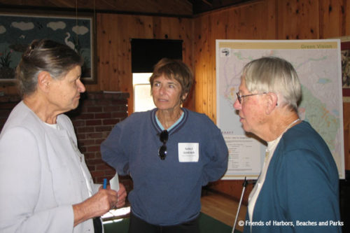
Creation and leadership of the Green Vision Coalition.
-
Negotiation, creation, and implementation of the advanced mitigation program in the Orange County Transportation Authority’s (OCTA) Renewed Measure M, leading the permanent preservation of 1,300 acres of natural lands and the restoration of 350 acres.
-
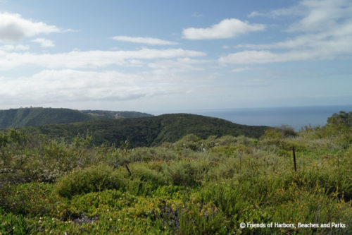
Creation and adoption of natural lands policies in sustainability and planning documents in Orange County and across Southern California.
-
Researched and authored numerous toolkits, research papers, and studies to assist cities and planners create more sustainable developments.
-
Co-founded and facilitates the Safe Trails Coalition which aims to find the balance between natural resource protection and recreational trail use.
HISTORY OF ACHIEVEMENTS
1997
Ten activists created Friends of Harbors, Beaches and Parks (FHBP) as a non-profit 501(c)(3) organization.
2000
GreenInfo Network was hired to prepare the first Green Vision Map.
2004
More than 60 community groups and non-profits at the local, regional, state, and federal level organized under FHBP’s leadership to create the Green Vision Coalition.
 2005
2005
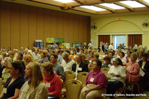
FHBP, in partnership with the Local Government Commission, hosted a “Resource Conservation Conference” at the Hyatt Huntington Beach where land use advocates, business leaders, transportation agencies, government officials, and non-profits discussed pressing issues of mutual interest.
2006
The Green Vision Coalition appointed a four-member team to negotiate with the Orange County Transportation Authority (OCTA) to include a comprehensive mitigation program in the Measure M2 ½ cent sales tax renewal.
OCTA’s Renewed Measure M went to Orange County voters and passed with 69.7% of the vote. It required a minimum of five percent of the freeway program revenues be spent on habitat mitigation including acquisition, restoration , and management. Under our leadership, more than 30 conservation and community groups supported the transportation measure.
2007
The Environmental Coalition that Supported Renewed Measure M and FHBP was represented on the newly formed Orange County Transportation Authority’s Environmental Oversight Committee.
2008
FHBP published a General Plan Resource Directory, funded by The Boeing Corporation, that includes relevant and timely information on sustainable policies that offer the opportunity to reduce greenhouse gas (GHG) emissions and vehicle miles traveled (VMT), create convenient and vibrant communities, and ensure our natural resources are protected.
To improve communications between interested organizations and the County Parks Department, FHBP initiated and coordinated the “Quarterly Meetings” with the Director of OC Parks.
 2009
2009
When the County was considering accepting a donation of 20,000 acres from The Irvine Company, FHBP wrote letters and testified at public meetings about the importance of conservation protections on the land, future funding for management, and transparency to the liabilities and risks associated with existing Letters of Intent. Concerns were addressed and the land was eventually transferred to OC Parks as the “Irvine Ranch Open Space.”
2010
After the passage of SB 375 (the Sustainable Communities Act), FHBP began working with the Orange County Council of Governments (OCCOG) to write and then ensure adoption of California’s first conservation policy in a Sustainable Communities Strategy.
2011
FHBP released a “Park and Walk Score” analysis for all 34 cities in Orange County. Park Scores delineate the number of park acres per thousand residents and Walk Scores show how walkable a city is for the public.
 2012
2012
The Green Vision Map was updated to the parcel level, meaning each owner and assessor parcel number was identified for the protected, unprotected, and threatened properties. New guidelines were established to keep future iterations of the map consistent.
Working with the Southern California Association of Governments (SCAG), FHBP assisted in crafting the framework for a comprehensive mitigation program that is linked to SCAG’s Regional Transportation Plan. These policies were the second conservation-focused policies in the state to be adopted in a Sustainable Communities Strategy.
2013
As an addendum to the General Plan Resource Directory, FHBP completed the Healthy Communities Toolkit. This Toolkit, funded by The Boeing Corporation, describes the policies and best practices being pursued by communities in California and elsewhere to build healthier communities by directing growth into walkable neighborhoods in existing communities and conserving important local and regional agricultural and natural lands.
 2014
2014
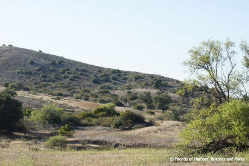
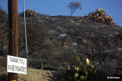
FHBP completed a study to understand wildfires in the Santa Ana Mountains and Laguna Coast. FHBP reviewed 100 years of data including fire perimeters, points of origin, and fire frequency.
2015
A Park Accessibility and Sufficiency Report for three park-poor cities was written by FHBP. The report outlines more than a dozen ways cities can improve parks and park programs.
2016
Under the leadership of FHBP, a 30+ member Southern California Conservation Coalition was formed to focus on the 2016 SCAG Regional Transportation Plan/Sustainable Communities Strategy. The Plan was adopted with a first-of-its-kind Natural and Farmlands Conservation Appendix including policies written by FHBP.
2017
FHBP held its 20th Anniversary event at the Muth Center in Newport Beach featuring a preview of the FHBP video called “A Simmering Unrest.” FHBP received numerous commendations from decision-makers representing Orange County.
2018
Through a generous grant from Eric Jessen, retired Chief of Planning, Acquisition and Development for OC Parks. FHBP released a video series in August that covered 120 years of OC Parks history. The 14-part series covers the major milestones that marked the establishment of the county’s parks, harbors, beaches, historic sites, and trail systems commencing in 1897 with the opening of Irvine Regional Park, the first of its kind in California. The videos are available on our YouTube Channel.
2019
The Henry W. and Ellen R. Warne Family Endowment Fund of the Orange County Community Foundation funded FHBP’s “The Efficacy of CEQA Mitigation: Orange County Case Studies to Determine What Works.” The report was released in December 2019 and outlined 12 restoration projects. In short, the success of the restoration projects depended on many things, including (but not limited to): site preparation, long term funding, on-site issues (such as wildfire) and removal of contractor materials (like waddles, PVC pipes, and fencing). Fifteen recommendations were included in the report to improve restoration project success rates and natural resource agency tracking efforts.
2020
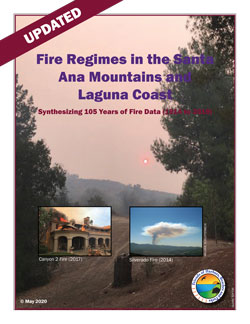 Grant funding allowed the Wildfire Study for the Santa Ana Mountains and Laguna Coast to be updated. It covers 105 years included 183 fire perimeters and 70 fire ignitions which totaled 218 separate fires in the Santa Ana Mountains. Similarly, the Laguna Coast count went up with 34 perimeters and 28 ignitions totaling 47 individual fires.
Through FHBP’s leadership, SCAG adopted a natural land preservation policy that is now one of 10 policies aimed at reducing greenhouse gas emissions and vehicle miles traveled. This was the first time in SCAG’s 55-year history that natural lands were incorporated as more than just an appendix. It took FHBP nine years to get this policy formally adopted and we built a 48 member coalition to support the policy.
Funding from the Warne Family Endowment Fund allowed for additional work reviewing and then mapping sensitive, threatened, and/or endangered species throughout Orange County. The projects reviewed spanned the County with 25 mixed use, residential, and infrastructure projects included of which only 17 projects qualified with needed species to document. In this project, 791 occurrences of rare, sensitive, threatened, and endangered species were mapped and submitted into the California Natural Diversity Database.
And, finally FHBP used the Green Vision Map to determine impacts to parklands including: tree infestations, sea level rise, and water quality.
2021
Multiple properties within the Orange County Transportation Authority’s Mitigation Program had threats including the Pacific Horizon and Silverado Chaparral Preserves (SoCal Edison habitat destruction), the Eagle Ridge Preserve (proposed permanent brush clearance from a neighbor), and The City Parcel restoration site (proposed unravelling of the restrictive covenant for primary and secondary access to a neighboring property). FHBP and others commented directly on these issues before decision making bodies. All of the issues were eventually resolved through commitments from the City.
FHBP engaged in the statewide 30×30 campaign, which aims to protect 30% of California’s natural lands and coastal waters by 2030. With partner non-profit, Hills For Everyone, 275 properties were documented for potential conservation totaling over 30,000 acres in and around Orange County, while FHBP built the coalition to support the letter and associated maps.
Throughout the year, multiple acquisitions occurred that filled in conservation wish list properties on the Green Vision Map, including Watson (98 acres), Newland Marsh (180 acres), First National Investment Properties (320 acres), Eastbridge (80 acres), Beattie (9 acres), Mitchell East (40 acres), and West Coyote Hills (East) (218 acres).
FHBP mapped the Green Vision Coalition territories in a Google Map accessible to the public. It includes contact information, location of the work, and a link to the group’s website if available.
2022
We commented on more than 50 projects, policies, and programs locally, regionally, statewide, and federally. FHBP was part of the team that stopped the sale of public parklands to a private landowner (and developer) at Upper Newport Bay Park and Preserve. We submitted a letter to the County on its lackluster response to the Grand Jury report on the sale. The Los Angeles Times wrote a great piece explaining the recent Grand Jury report on the proper noticing of public parkland sales and using the sale of the Back Bay parcel to a private individual as the perfect example. The recommendation to require the homeowner remove the fence is still at issue.
Through hard work, a coalition of groups defeated Poseidon, a desalination plant proposed for Huntington Beach. These efforts were led by Residents for Responsible Desalination and Orange County Coastkeeper. FHBP wrote letters to the City and Coastal Commission on this topic.
Supported The California Chaparral Institute and others in their litigation against CalFire for the proposed destruction of protected habitat lands in the name of fuel modification.
FHBP took a leadership role by engaging with the Orange County Transportation Authority to provide feedback on its mitigation preserves and planning efforts. Gave presentations to organizations like Sea and Sage Audubon Society on the importance of Regional Advance Mitigation Programs like the one with OCTA.
Supported the preservation of lands on the Green Vision Map, including the conservation of 387 acres of the Banning Ranch’s 401 acres by The Trust for Public Land. The property is now under ownership by the Mountains Recreation and Conservation Authority and is called the Frank and Joann Randall Preserve.
FHBP received a special recognition from Senator Pat Bates for our long standing work on conservation, land use and transportation mitigation projects in Orange County. Senator Bates presented this recognition at Upper Newport Bay and honored the work done by FHBP Consultant Melanie Schlotterbeck.

2023
Through two funding sources FHBP hosted eight virtual workshops to train the community on the state’s goal to protect 30% of California’s lands and waters by 2030 (called 30×30). We partnered with the statewide and Southland Power In Nature Coalitions to get out the word about 30×30 workshops, specifically the 10 pathways to protecting lands and waters, plus funding opportunities. Through coordinated promotion of the 30×30 workshops, FHBP reached thousands of groups and with 577 participants registering for the workshops. All workshops included Spanish interpretation, and all materials are posted to the FHBP YouTube channel and our website in both English and Spanish. All videos and webinars include close captioning.
Through its Green Vision Map and recently updated parcel data, our consultants also outreached to 45 landowners with properties five acres or more within 500 feet of a known state/federally listed species to see if they were interested in selling their land for conservation. So far, four landowners have contacted us for more information.
We were thrilled to announce that the City of Brea adopted a Native Tree Preservation Policy last night. It includes eight native tree species (such as oaks, willows, and sycamores), covers all properties within the city that are 20,000 square feet or greater and all commercially zoned properties. It requires a replacement of native trees at a specific size and at a certain replacement ratio.
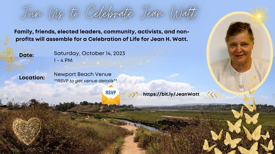
The world lost the incomparable Jean Watt on April 10, 2024 (at the age of 96). Melanie Schlotterbeck wrote an Opinion Editorial on Jean Watt for the Voice of OC.
We continue to lead the way on regional plans working to improve conservation of natural and farmland policies. FHBP participated in a special Community Partners funding opportunity with Southern California Association of Governments (SCAG) to relay additional feedback on housing, the environment, and mobility. We hosted a virtual bilingual workshop as a call to the community and organizations of Imperial, Los Angeles, Orange, Riverside, San Bernardino and Ventura! Without unity there is no community!
We continued to participate in the Southland 30×30 Power In Nature Regional Coalition, Green California, and Measure M’s Environmental Oversight Committee. We celebrated and congratulated Senator Dave Min for getting SB 337 to the California Governor’s Desk. FHBP supports 30×30 and this bill codifies the conservation goal to protect 30% of CA’s lands and coastal waters by 2030.
2024
FHBP coordinated a coalition spanning multiple counties that encouraged the Southern California Association of Governments (SCAG) to adopt strong natural and farmland policies. Due to our work, SCAG found a substantial flaw in its scenario planning module that reduced the baseline natural/farmland policies considerably. Our comments pointed out the error and allowed revised numbers for the final document. FHBP and others supported the 2024 Regional Transportation Plan and Sustainable Communities Strategy. The Plan was formally adopted in April 2024.
Again, FHBP’s leadership was fruitful with the adoption of the SoCal Greenprint by SCAG. This tool will help with the potential for advanced mitigation throughout the six countywide region. Beta testing on the online mapping tool has been delayed while SCAG seeks a partnership with Caltrans to maintain the map.

In July, FHBP launched its Park Legacy map. FHBP Consultants researched the acquisition history of each regional and wilderness park in the OC Park system using publicly available documents. This research led to the creation of two digital Story Maps, highlighting Orange County’s park heritage. The Park Legacy Story Maps detail the history of 15 Regional and seven Wilderness Parks, showcasing preservation efforts. Developed with ESRI’s ArcGIS Online, these maps are visually appealing and easy to navigate, offering historical documents, photographs, and parcel data. This project aims to educate the public and inform decision-making about these parks’ conservation.
FHBP supported the $10B climate bond on the November 2024 ballot as Proposition 4. It was approved with 59.8% of the vote. Funds for conservation activities will now be available, no sooner than July 1, 2025.